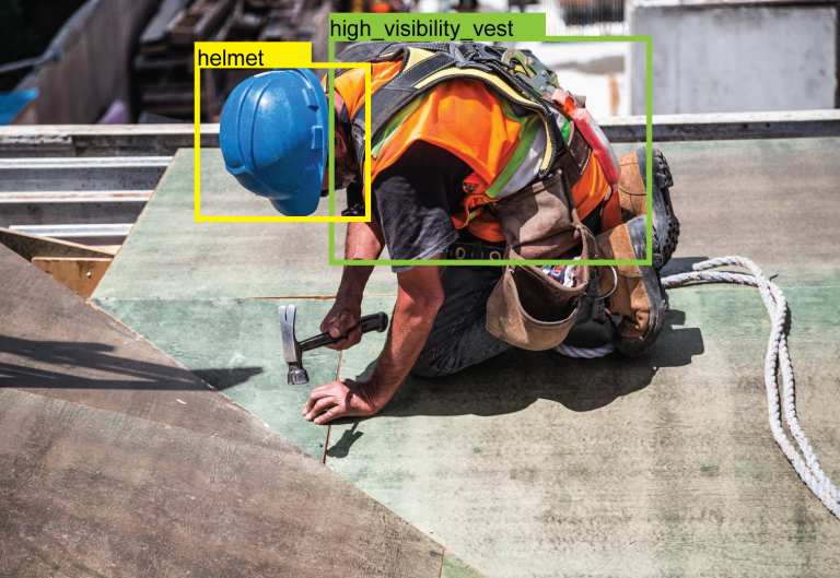
Drones have become a standard tool in industrial inspection. From large UAVs covering kilometers of road infrastructure to compact drones inspecting offshore platforms, they’ve made it possible to survey structures and environments that are dangerous, expensive, or simply impractical for human inspectors to reach on foot.
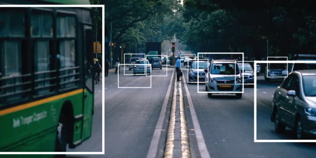
But gathering aerial footage is only the first step. A drone without intelligent analysis is just a flying camera – it collects data faster, but someone still has to watch every minute of footage and interpret what they see. The real value unlocks when AI video analysis processes that footage automatically, identifying defects, flagging anomalies, and generating actionable reports without a human analyst reviewing every frame.
At Agmis, we develop the computer vision models that turn raw UAV footage into structured, actionable inspection data. We work with drone operators across industries – they handle the flying, we handle the intelligence. In our deployments, this approach has delivered measurable results: our work on AI-powered road inspection with Lithuania’s national road authority reduced inspection-related CO2 emissions by 90%, and our AI object detection work with Broswarm – a NATO Innovation Challenge winner – helped enable autonomous landmine detection across multiple terrain types.
How AI Video Analysis Works for UAV Inspection
The process is straightforward. Drone operators capture aerial footage using high-resolution cameras, infrared sensors, or specialized radar systems depending on the inspection type. That footage is then processed by AI models trained to detect specific defect types, structural anomalies, or environmental changes relevant to the industry.
The AI doesn’t replace the drone operator’s expertise in flight planning and data capture. It replaces the hours of manual footage review that follow. Instead of a human analyst scrubbing through thousands of images looking for cracks, vegetation overgrowth, or thermal anomalies, the model flags locations of interest automatically – with GPS coordinates, severity classification, and supporting visual evidence.
Every model is task-specific. A model trained to detect road surface cracks won’t identify corrosion on a wind turbine blade. Each inspection domain requires its own training data and defect taxonomy, which is why customization matters more than generic “AI inspection” capabilities.
UAV Inspection Applications by Industry
Agmis develops task-specific computer vision models for a range of aerial inspection scenarios. A high degree of customization is applied to each use case – the defect types, environmental conditions, and reporting requirements differ significantly across industries.
Power line inspection
AI models detect vegetation encroachment, insulator damage, and structural wear along transmission corridors. The system flags areas requiring closer inspection or immediate maintenance, eliminating the need for line crews to work at height for routine surveys.
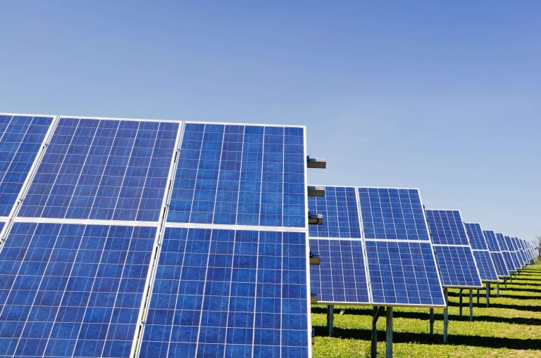
Solar farm monitoring
Beyond damage detection, UAVs combined with AI analysis support site planning and energy harvest estimation. Thermal imaging identifies underperforming panels, while visual analysis detects physical damage across large installations that would take days to walk manually.
Offshore oil and gas platforms
UAVs access otherwise inaccessible structures without scaffolding or rope access teams. AI analysis of the footage enables detailed inspection of critical components for maintenance planning – reducing the need for production shutdowns associated with manual inspection.
Roads and bridges
AI analysis creates maps of road surface cracks and structural discrepancies across inspection areas. Studies have shown that UAVs can detect concrete cracks on bridges smaller than 1cm, even in low-light conditions. This dramatically reduces the time inspectors spend near heights or speeding traffic.
Railway infrastructure
Drones increase both the frequency and detail of railway inspections while reducing costs. AI analysis processes the footage to identify track defects, damaged assets, and areas requiring preventive maintenance – improving safety for railway personnel who would otherwise inspect these sections on foot.
Pipeline monitoring
Underground pipeline leaks are detected through drone-captured imagery combined with AI analysis that generates high-resolution vegetation maps showing plant kill-off zones and signs of leaks. Infrared cameras paired with AI identify hotspots indicating potential defects in pipeline insulation.
Industrial and manufacturing assets
Chemical plants, construction sites, and manufacturing facilities all benefit from aerial inspection. AI models process UAV footage to report areas of concern, suggest preventive maintenance tasks, and identify necessary repairs – covering assets that are difficult or dangerous to access manually.
The Partnership Model: Operators Fly, AI Analyzes
There is a diverse ecosystem of specialist drone operators worldwide, each with deep expertise in their sector – offshore, energy, transport, agriculture. They employ highly skilled pilots equipped for the specific conditions of each inspection task.
Agmis works alongside these operators as a video analysis partner. The operators handle flight planning, data capture, and on-site logistics. We provide the AI models that turn their footage into structured inspection reports. This separation of concerns means operators don’t need to invest in building analysis software or hiring data scientists – they focus on what they do best, and the AI handles the rest.
Machine learning models improve continuously. Every inspection processed refines the model’s accuracy for that defect type and environment. UAV operators working with Agmis benefit from models that get better with each deployment – without managing the AI development themselves.
For a deeper look at how this approach works at national scale, read our analysis of AI-powered aerial inspection for large-scale infrastructure monitoring, including how the reconnaissance-first strategy reduced road inspection emissions by 90% across 21,000+ kilometers of Lithuanian national roads.
If you’re a drone operator looking for an AI video analysis partner, or an infrastructure manager evaluating how to get more value from aerial inspection data, we’d be happy to discuss what’s possible with your existing footage.
Reach out with questions about software development, process automation, or AI-powered solutions - no commitment required.
Drop us a message, send an email, or find our contact details on the page. We'll get back to you promptly to discuss your goals and outline the most effective next steps.