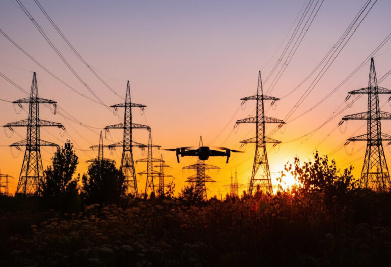
Aerial PPE inspection uses drone-captured footage analyzed by computer vision AI to monitor safety gear compliance across large construction and industrial sites in real time. Unlike fixed cameras or ground patrols, it covers entire worksites continuously – flagging violations in seconds, without requiring safety personnel to be physically present at every corner of a site. For sites measured in hectares rather than square meters, it’s the only approach that actually scales.
The Problem Aerial PPE Inspection Solves
PPE policy documents are easy to write. Enforcement at scale is where the gap opens.
A safety inspector on a 5-hectare construction site cannot physically observe more than a small fraction of the workforce at any moment. Workers know this. Compliance rates drop in zones that aren’t actively watched, and the highest-risk areas – elevated platforms, remote perimeter work, areas near heavy machinery – are often the hardest to monitor precisely because they’re difficult to access.
Fixed CCTV addresses some of this, but large outdoor sites have too many blind spots for a fixed camera network to be practical. Trenches change position. Scaffolding moves. New work zones open and close week by week. A static camera grid designed at project start is outdated within a month.
Aerial PPE inspection – drone footage processed through trained AI models – solves both problems. Coverage follows the work, not the camera mounting points. And the AI doesn’t tire, doesn’t take breaks, and doesn’t miss non-compliance because it was watching somewhere else.
How Aerial PPE Inspection Actually Works
There are two distinct components: the drone that captures footage, and the AI that interprets it. These are separate capabilities, and confusing them leads to unrealistic expectations on both sides.
The drone handles flight planning, data capture, and on-site logistics. Operators plan patrol routes, determine altitude and camera angle for usable resolution, and manage flight operations. This requires skilled pilots with site-specific experience.
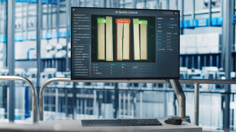
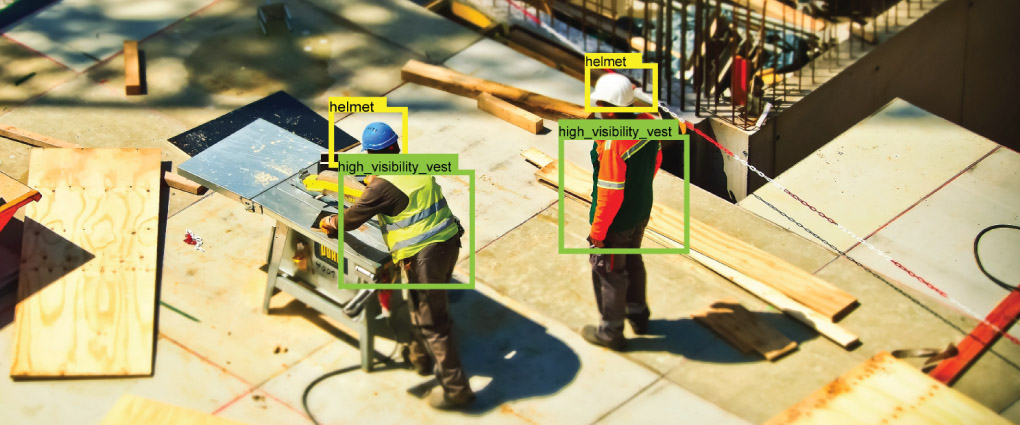
The AI handles everything that happens to the footage afterward. Frames are analyzed to detect people in the frame, then each person is assessed for visible PPE items – hard hats, high-visibility vests, safety goggles, harnesses, gloves. Non-compliance triggers an alert with GPS coordinates, timestamp, and a captured frame. Compliance data accumulates into reports that show patterns over time: which zones have the highest violation rates, which shift, which weather conditions.
The AI models are task-specific and trained on annotated datasets from real construction and industrial environments. A model trained on food manufacturing footage won’t perform well on a wind farm. Deployment that actually works requires domain-relevant training data – which is why off-the-shelf solutions often disappoint.
Agmis develops the computer vision layer. We’ve deployed AI object detection models in manufacturing environments reaching 93% accuracy on hard hats and high-visibility vests, and 100% accuracy on face masks. The same model architecture applies to aerial footage, with adaptations for variable altitude, lighting, and camera angle.
What Aerial PPE Inspection Can Detect
Detection capability depends heavily on flight altitude and camera resolution. At practical patrol altitudes (20-40m), well-trained models can reliably identify:
Items requiring close proximity – safety goggles, gloves, ear protection – are harder to detect reliably from patrol altitude. Honest system design acknowledges these limits and positions aerial inspection as a complement to, not a replacement for, close-range monitoring in confined areas.
Where Aerial Inspection Outperforms Fixed Cameras
Fixed camera AI and aerial AI solve different problems. Understanding the distinction prevents expensive mistakes.
| Scenario | Fixed cameras | Aerial inspection |
|---|---|---|
| Static facility, defined entry points | ✓ Ideal – install once, monitor continuously | Overkill – unnecessary complexity |
| Large outdoor site, changing layout | Expensive blind spots, constant repositioning | ✓ Coverage follows the work automatically |
| Remote or hazardous areas | Infrastructure installation impractical or dangerous | ✓ No infrastructure needed – drone flies to the zone |
| Temporary construction project | Poor ROI for short-term deployment | ✓ Deploy per project, move to next site |
Real Deployment: What the Numbers Look Like
The Mantinga food manufacturing deployment – where Agmis’ computer vision models achieved 93% accuracy on hard hats and high-visibility vests using standard IP cameras – establishes a performance baseline for fixed indoor environments. The same underlying model architecture transfers to aerial applications, with the key engineering challenge being variable altitude and lighting rather than the detection logic itself.
The 3-month construction safety pilot with Merko and Mitnija tested computer vision for site compliance in live construction conditions. Large, active sites with dozens of workers across multiple zones. The practical finding: AI monitoring changes behaviour. When workers know compliance is tracked continuously rather than during spot inspections, the compliance rate improves – not because enforcement is heavier, but because the expectation of monitoring becomes constant rather than intermittent.
From the field
“The hardest areas to monitor were also the highest-risk areas – elevated work, perimeter zones, machinery proximity. These were exactly where spot inspections weren’t reaching. Aerial monitoring closes that gap.”
Observation from Agmis construction safety deployments
Limitations Aerial PPE Inspection Can’t Overcome
Any vendor who presents aerial PPE inspection without its limitations is selling you a marketing brochure, not a system. Here is what it genuinely cannot do.
Who Should Implement Aerial PPE Inspection
The technology earns its cost at a specific site profile. If your situation matches most of these, it’s worth a serious evaluation.
If your site is a fixed indoor facility with defined entry points, fixed-camera AI PPE detection is almost always the better solution – lower cost, higher uptime, unaffected by weather.
Getting Started with Aerial PPE Inspection
The typical deployment path follows three phases. The first is a site assessment: what zones need coverage, what PPE items are mandatory, what resolution is needed to detect them, and whether regulatory clearance for drone operations is already in place or needs to be obtained.
The second is model configuration and testing. AI models need to be trained or fine-tuned on footage from your specific environment – lighting conditions, worker density, camera angles from planned patrol routes. A model tested in different conditions will underperform.
The third is operational integration. Who receives violation alerts? What’s the escalation path? How do compliance reports feed into your safety management system? The AI produces data – the workflow determines whether that data actually changes anything on site.
Agmis works on the AI layer: model development, integration with existing camera or drone footage pipelines, and dashboard configuration. We work with operators who handle flight logistics, or alongside clients who manage drone operations in-house. See our aerial inspection capability overview for the broader context of how AI video analysis applies to infrastructure monitoring.
Frequently Asked Questions
Reach out with questions about software development, process automation, or AI-powered solutions - no commitment required.
Drop us a message, send an email, or find our contact details on the page. We'll get back to you promptly to discuss your goals and outline the most effective next steps.